


VTD-precinct 13, Clark County, South Dakota
About
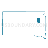
Outline

Summary
| Unique Area Identifier | 667119 |
| Name | VTD-precinct 13 |
| County | Clark County |
| State | South Dakota |
| Area (square miles) | 35.14 |
| Land Area (square miles) | 35.06 |
| Water Area (square miles) | 0.09 |
| % of Land Area | 99.75 |
| % of Water Area | 0.25 |
| Latitude of the Internal Point | 44.84123320 |
| Longtitude of the Internal Point | -97.80615600 |
Maps


Graphs
Select a template below for downloading or customizing gragh for VTD-precinct 13, Clark County, South Dakota


Neighbors
Neighoring Voting District (by Name) Neighboring Voting District on the Map
- VTD - Clark city ward 1 precinct 11, Clark County, SD
- VTD-Clark city ward 2 precinct 12, Clark County, SD
- VTD-Clark city ward 3 (part of precinct 13), Clark County, SD
- VTD-precinct 2, Clark County, SD
- VTD-precinct 3, Clark County, SD
- VTD-precinct 5, Clark County, SD
- VTD-precinct 6, Clark County, SD
Top 10 Neighboring County Subdivision (by Population) Neighboring County Subdivision on the Map
- Clark city, Clark County, SD (1,139)
- Fordham township, Clark County, SD (111)
- Lincoln township, Clark County, SD (94)
- Day township, Clark County, SD (85)
- Garfield township, Clark County, SD (60)
- Merton township, Clark County, SD (51)
- Darlington township, Clark County, SD (50)
- Logan township, Clark County, SD (43)